Route options from Europe to the Americas for ships
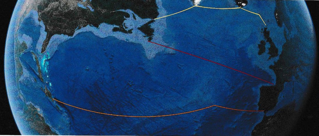
This map from Google satellite still does not give a true indication of the scale differences re the distances – the true effect is shown on the surface of a sphere . Columbus’s route is orange with one stop, the Basque and French explorers/fishermen are red, and the Norse clnd the Orcadians yellow (with three stops).
The Black Death in Europe started in 1347 and eventually reached Iceland in 1402. Overall it is reckoned half the population died a horrible death. This “first” Black Death never reached Greenland. Their key trade had been walms ivory, as used for the Lewis chessmen made about 1200AD. The Greenlanders traded for the ivory with the local Inuit (one of whom even carved the likeness of a Eµropean trader). But supplies from Russia, and African elephant tusk ivory had come to be preferred. Anyway, as a luxury item, in troubled times, demand was nil. Especially because of the Black Death, traders had not come. When they did arrive in Iceland in 1402 carrying the disease, the result was devastating. Only by serendipity, when, with climate degradation due to the Little Ice Age, the Greenlanders, in desperation came east, they found the epidemic, for the time, had abated. There was vacant land aplenty available amongst their kindred. Some will have come to the Orkneys, and passed on tales of Greenland, Merkland with its timber reserves, and Vinland (North America proper). Though all far away, reachable by manageable stages.
Why wouldn’t the Orcadians, until 1468 Norwegians, mount expeditions to the west, which could be on a small scale. The first (and successful) 1497 expedition direct from Bristol to Newfoundland by John Cabot had a crew of 18 on the Matthew – only 50 tons. The northern route makes the most sense. The snag is as walrus ivory was no longer of value, there was nothing for Europeans in America. An indigenous community was in place. When the Pilgrim Fathers landed, the “JocaJs” had been ravaged by the diseases brought over by Europeans and land was available for settlement. Even then, the success of the colony was touch and go, and initial English efforts in Virginia failed.
Here is a version of the Ptolemy map produced by G Kempensis in 1584′ and very similar to what was available to Columbus in 1497
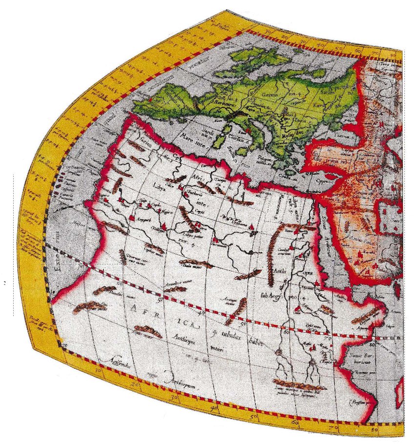
Even for Europe, the omissions and distortions are manifold, (no Norway/Sweden in Scandinavia) – but see the amount that is correct. Henry V11 willing, Columbus would have departed on his quest from Bristol as he had travelled up the west coast’ in 1477 to Iceland where it is claimed he stayed the winter, hearing tales of Greenland and Labrador.
It is uncanny that as late as 1584, this 2nd century AD data re the geography of the world was still valid. Greeks in the Eastern Mediterranean had known the world was represented by a sphere. That most of it was “blank” must have been a huge challenge. Making spheres also would have been difficult. The “flat” methodssuggested by Ptolomy were a practical solution. To this day, representations of the earth’s surface “on the page” gives a challenge not resolved.
But going to Iceland, learning of the inhospitability of any lands to the west, Columbus would known going from further south would be more likely to lead to the wealth of China. About 40 years before, remaining Greenlanders had returned with tales of the harsh climate there. Invaluable hearsay information passed on by the Orcadians, whose Earl had been appointed by the Norwegian king before he and all Orcadians were cast adrift from Norway to become part of Scotland. Columbus was sure lands were at the other side of the ocean to the west, but to the north, not the rich lands described by Marco Polo in 1300 or those on the Fra Mauro map3 of 1450, drawn in Venice and mentioning Grolanda – Greenland.
January 2026 A Roman Marching Camp hidden in Plain Sight
29th June, Mineralwell, Stonehaven 10 – 5.30
. . . come to the annual Thomson Memorial Classic Car Show – which has something for all the family and is a trip down memory lane. R W Thomson, inventor of the pneumatic tyre, died on the 8th March 1853 but his life expectancy then would have been about 41 years.
(As well as hygiene improvements, what has made a huge difference since has been immunisation, starting in the UK in L79B with Jenner for smallpox. The Iatest application to counter the Covid virus was a game changer for us all. Vaccine sceptics do us all a grave disservice.)
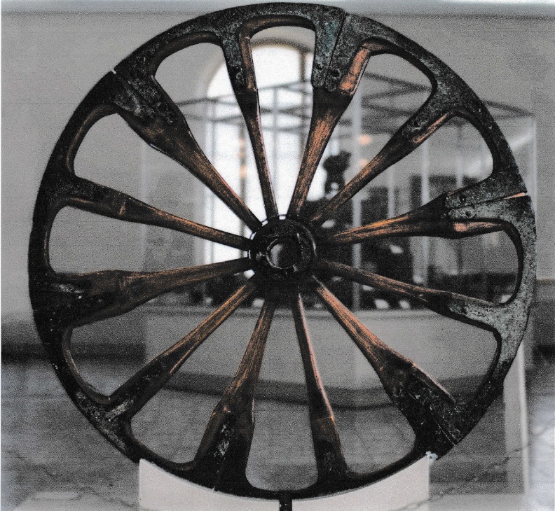
For June, upstairs in Stonehaven Library – open Tue 9-6, Wed & Fri 9-5, & Sat 10-2 is a “taster” display illustrating the invention’s place in the history of the wheel arguably the most important mechanical invention ever made.
Plus, downstairs, a table featuring the A to B magazine with a unique “take” on suggestions to make our lives just that little bit more “sustainable”.
Here is a picture of the first “Spoked” wheel we know of – from Iran – when the Middle East was at the leading edge of technology.
The Puddock
1665 And All That
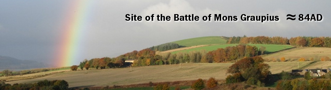
In March, go upstairs at Stonehaven Library (open Tue 9-6, Wed 9-5, Fri 9-5 & Sat 10-2) and see OLD and NEW (to me!) information, which, looked at with “fresh eyes” – says there also was a Roman Marching Camp built at Fordoun in 84 AD, when the Romans came to Kincardineshire:-
- NEW Jarvise, THE 1890s local expert, writes that the Fordoun Marching Camp exists.
- NEW The Bervie Water was a line of lochs & bogs & a major ancient tribal boundary
- NEW In North Britain, the Romans “Created a Desert & Called it Peace”
- NEW The 1757 Bertram Map forgery caused bad & “GOOD” data to be rejected.
Local Kincardineshire folk have, all along, maintained that the Marching Camp existed.
Added to the other evidence from
- William Roy’s Great Map of Scotland shows Roman sites which he does not mention!
- A letter and map, written by the Rev James Leslie on the 26th March 1799, and IS THE KEY SOURCE KEY DOCUMENT.
- The 1860s Ordnance Survey testimony by Kincardineshire locals.
Plus :– The undefended Milltimber Roman Camp found during the building of the AWPR
View Transport Scotland + highway through history + pages 86 – 96
The video shows a road – straight over the north of Knock Hill – just as the Romans built them!
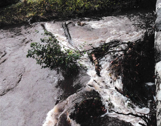
STORM BABET AND THE BERVIE WATER
During storm Babet the old turnpike Bridge of Mondynes, as the photo shows, had one arch blocked by four large tree trunks and snagged branches – a full tree coming – the bridge would have been a dam.
Scottish Government policy encourages riparian tree growth, and when bridges are involved, this is a nonsense and has to be changed.
SAVING LIVES with Polymers in Action
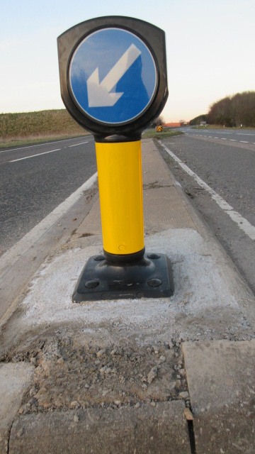
Here at Thistle.uk.com, we specialise in providing innovative solutions to “problems” using thermoset polymers for oilfield applications and special rubber belting & tracks, so, when we saw that the central reservation signs were of very poor design relative to their function, as well as being vociferous in asking for sign alteration from BEAR & Transport Scotland (whom we know and respect), we looked at what we would propose ourselves, being on the point of making a costed proposal, when they indicated that they had a new version to trial. “Our” old steel posted version had been destroyed at least nine times and, right here, there was a major accident waiting to happen. I have already reported that the new version had been knocked down to 45 degrees, and, after waiting a week or so for it to be “fixed”, late one night I went to it and was able to straighten it up – as good as new. The cost of the alteration was already saved.
A few days ago, Bingo, exactly the same, the sign, still visible doing its job, was at 45 degrees to the north, having been hit again. This time, with my best head torch and at midnight, when traffic was almost zero, I went to take a closer, analytical, look with a designer’s eye:-
The top back of the sign was badly scuffed – the sign had in fact been knocked down the full 90 degrees and had bounced back. This is due to the careful design of the base polymer portion. It bulbous nature is such that there is enough “give” so that the plastic deforms instead of breaking. More than that, when I pulled the sign up firmly, the plastic responded by returning to its original dimensions. Very clever, and something I had not thought about in my own proposals. It will not survive if the tyre goes over it, but there is a good chance it can “recover” from most head-on impacts – and I guess the miscreants who “hit” it are not aware of how lucky they are! We spoke to just one of the nine who “hit” the steel version. She ended immobile in the north bound lanes. The truck bearing down on her was able to stop and the driver helped push her car, (a right-off), off the road. She reckoned she was very lucky!
The new sign calls itself and “I-sign” and says its maker is Pudsey Diamond – it is clever!
PS Do call into the Stonehaven Library for my “show” commemorating the 100th anniversary of the foundation of the BBC on the 18th of October 1922.
For a holiday destination. try – HMS UNICORN IN DUNDEE
It is easy to get to – train & bus take you to the centre of the city with no parking worries, & is open 10.00am – 4.00pm Tue – Sun and gives just a hint of life in the early 1800s. To our eyes horrendous, but, then, state of the art stuff. They have an exhibition featuring the “engineering” of Robert Sepping, the ship’s designer. The design of “wooden” ships in the UK was an evolving and innovative process. It was by staying one step ahead of the “opposition” in ship (and armament design – think the Falkirk carronade cannons) technology, as well as the ability of the UK’s seamen – that the UK’s ships were able to prevail.
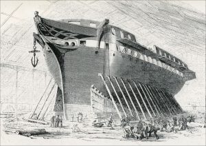 A career in the navy as an officer was considered a great prospect even during the Napoleonic wars. In Flitting the Flakes, the diary of Dr James Badenach of Whiteriggs, we see his two sons went off to the navy – to war, and so far as we know, did not return, and yet, for, say Admiral Duff at Fetteresso (his father had 30 children!), the Royal Navy was a route to recognition and prosperity. It is the poor folk, the likes of the fishers of Johnshaven, who were press-ganged, who were drawing the short straw – the ships became like prisons for
the crews.
Do consider Dundee for a day out. There is the Quay Restaurant close by the Unicorn with excellent fare, and the City and V & A Museums, the Discovery, plus perhaps a walk over the Tay bridge – plenty to do.
By car, city centre parking can be an issue. I recommend visiting the University Of Dundee Botanic Gardens on the Perth Road, (with a restaurant for refreshments) and to take in the City Centre, park at the Tesco supermarket, well priced groceries and petrol, and three hours parking – time for a quick look at the Unicorn too.
God is with us – UKRAINE!
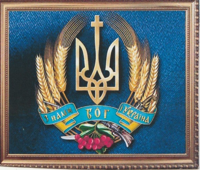 This flag is of a banner design received from Ukraine showing the country’s emblems. It includes a sword & rifle and the exhortation “God is with us – UKRAINE!” They deserve both God’s support & ours. Putin has & is using the methods of Stalin & Hitler.
We, here in the “Celtic” world, have closer ties with Ukraine than you think. The first Irish histories claim that Scythians (from the Ukraine areas) in the mists of time, came, via Spain, to be established in Ireland and brought the King & High King system of ruling. The Declaration Of Arbroath (do see the new exhibion at Arbroath Abbey), Scotland’s foundation charter, says a further group of Scythians, coming later on the same errand to Ireland, were directed from Ireland, on to our lands. They, with superior weaponry, took over as rulers but GIVING WOMEN much MORE INFLUENCE THAN NORMAL. It all sound pre-eminence, and then lost it.
This further, and last, group of Scythians, coming to Ireland on the same errand, were directed from Ireland to our lands. We now know they were called, by the Greeks, the Suarmatae and had always given women influence and the female lineage a vital role in determining who achieved “ruler” status – they certainly thought women worth listening to! Just what our Caledonian & Pictish ancestors did way back when!
Fighting Fascists, Ukraine needs God’s & our help now!
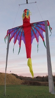
Fred’s Flags – & Dragons
This is the Year of the Dragon and at Bridge of Mondynes I regularly fly the Dragon.
There is an excellent flag display, and, for those who “know” Grassic Gibbon’s “Scots Quair” – and, (ladies especially) it paints an interesting picture of our land as it was – they will be aware that, folklore then maintained that, way back in the mists of time, a fearsome beast haunted our locale. The landless knight who destroyed it was granted the lands around, and the myth maintains that, 800 years ago, that is how the original Arbuthnott came to be granted the lordship here. A lovely story, and the dragon you now see, right here at Bridge of Mondynes, is a reminder – though this dragon, flying on high – is still safely tethered.
Another “myth” mentioned is how the primitive inhabitants had to flee from the invading Romans – and this is not far fetched at all, and a remarkable example of “folk memory” retaining true events – over millenia. I don’t know, yet lake pollen analysis in Aberdeenshire (and also, more surprisingly, in Fife) just after, as near as can be determied, 84 AD (when the Romans under Agricola came here, won a huge victory and pillaged the land) – regrowth of trees showed that the growing of crops was dramatically reduced – so the land ahd been denuded of people.
More generally, especially before 1747, when the law in the United Kingdom was changed to forbid the carrying of pistols, swords and arms of all kinds, Highland Clansmen felt “entitled” to “lift” (their neutral term for stealing) Lowlanders cattle – they maintained that, in times past, they had held the Lowlands , and were forceably deprived. In particular I cannot understand how, in the USA, old UK legal precedent says our forefears were free to carry arms. From 1747 that was not true, and the changes made then to “feudal priviledge” were the start of huge improvements in the life of all local folk – for even lords (with their followers) had been foced to follow their superiors into wars – whether they wished to or not. And this had applied even here, for in Dunnottar Castle is a list of the tenants of the Lord Marischal who were required, in 1651 – 52, to help defend the castle for King Charles – they all, even Ogilvie the commander, had little say & no thanks.
“Food for thought”